
Weather
Injuries reported after tornado touched down in Scotts Valley
According to a preliminary survey, the tornado was classified as an EF-1 on the Enhanced Fujita Scale.
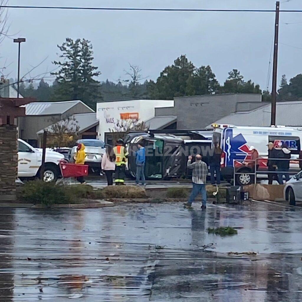
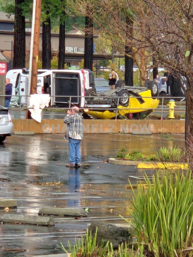
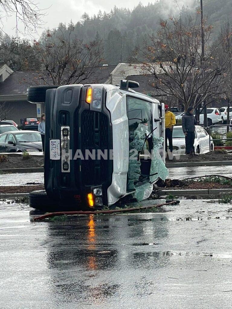
Scotts Valley, CA – Severe weather wreaked havoc across the United States over the weekend, with a tornado striking near a shopping mall in Scotts Valley, California, overturning vehicles, uprooting trees, and sending several people to the hospital.
Meanwhile, in San Francisco, authorities issued the city’s first-ever tornado warning.
The tornado touched down near Scotts Valley, approximately 70 miles south of San Francisco, around 1:40 p.m. on Saturday.
The National Weather Service (NWS) confirmed the tornado caused significant damage, particularly along Mount Hermon Road.
A tornado was reported to have touched down in Scotts Valley in Santa Cruz County, the NWS says.https://t.co/WEtYDDdbzU pic.twitter.com/6skkGu2ZXS— News Channel3 Now (@newschannel3now) December 14, 2024
According to a preliminary survey, the tornado was classified as an EF-1 on the Enhanced Fujita Scale.
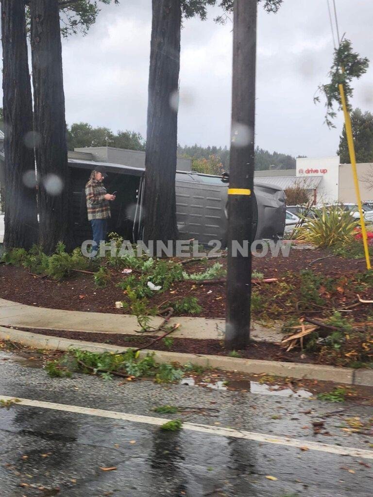
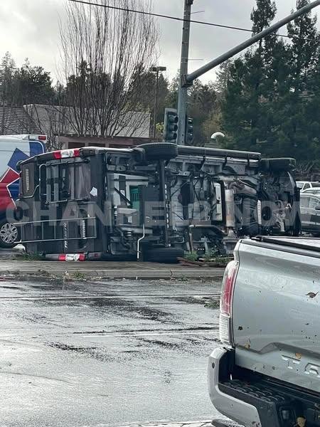
The tornado overturned at least six vehicles, toppled utility poles, uprooted trees, and damaged several businesses in the area, including a Target and a McDonald’s.
Notably, their iconic signs were destroyed. Scotts Valley Police Department reported five injuries from the event. Four individuals were treated and released from the hospital, while one person remains hospitalized with a punctured lung.
Among those impacted was a CAL FIRE battalion chief whose vehicle was briefly lifted by the tornado.
He was hospitalized as a precaution and is reportedly in good condition.
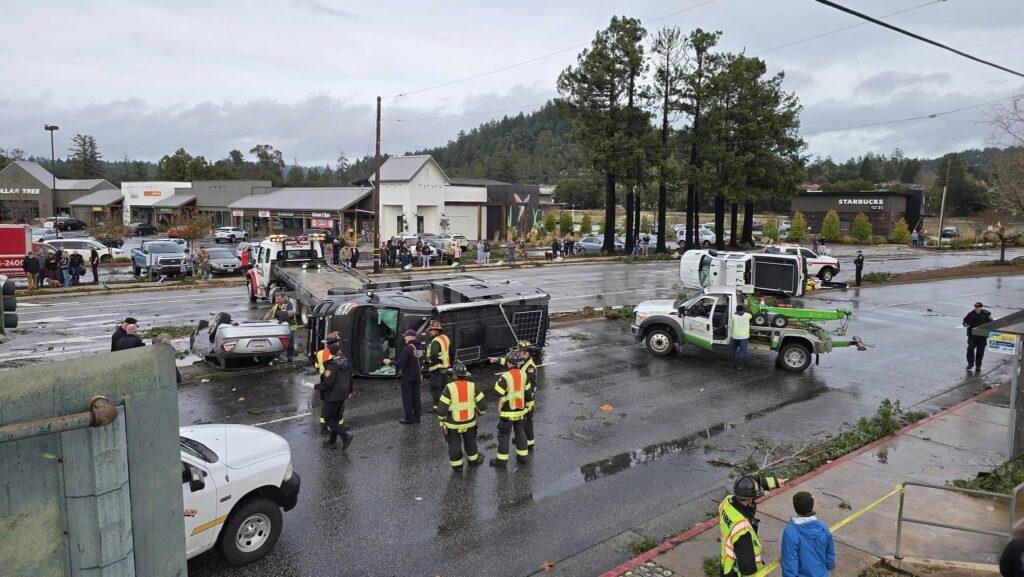
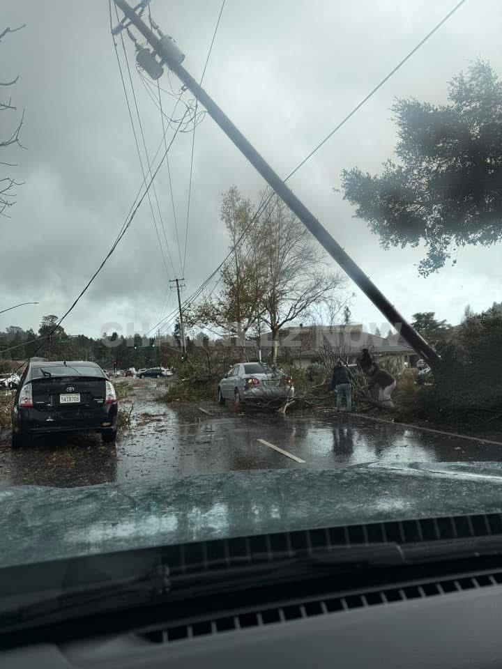
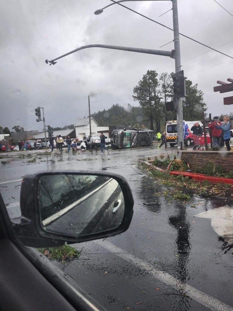
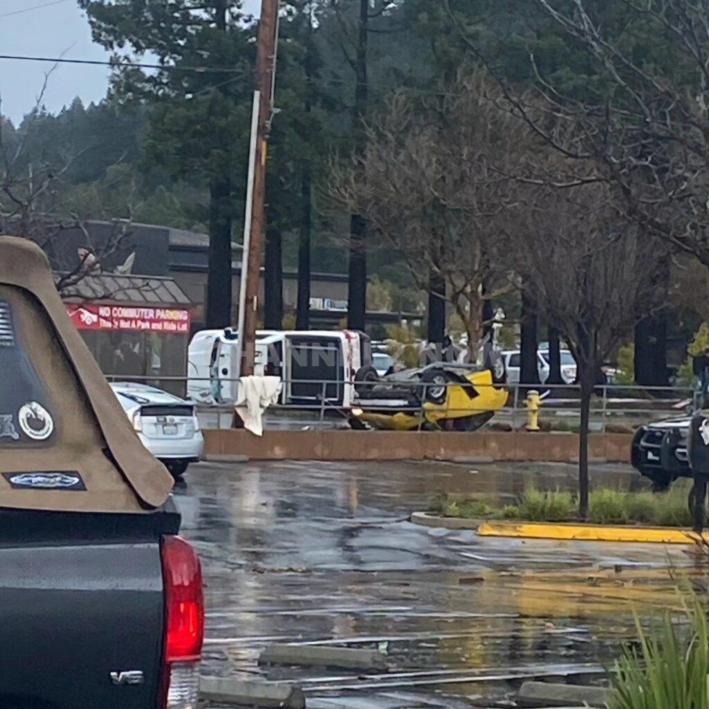
Mount Hermon Road, the epicenter of the tornado’s impact, remains closed between Scotts Valley Drive and Lockewood Drive. Police expect the road to reopen on Sunday morning after Pacific Gas & Electric (PG&E) completes repairs to damaged power lines and poles.
The damage assessment is ongoing, and there is currently no estimate of the total financial loss caused by the tornado.
While Scotts Valley bore the brunt of the tornado, San Francisco issued its first-ever tornado warning.
This rare alert was prompted by rapidly intensifying conditions in the area. Although no tornado touchdown has been confirmed within the city, damage consistent with high winds was reported, including fallen trees, debris in the streets, and damaged rooftops.
Meteorologist Roger Gass from the NWS office in Monterey emphasized the significance of the warning, noting that it marked the first advanced tornado alert for San Francisco since records began.
The last known tornado in the city occurred in 2005, striking without a warning.
The tornado in California was part of a larger system of inclement weather impacting the nation. In the Midwest, a significant ice storm created hazardous driving conditions in Iowa and Nebraska, forcing temporary closures of Interstate 80.
Meanwhile, in upstate New York, a snowstorm dumped over 33 inches of lake-effect snow near Orchard Park, leading to treacherous conditions.
The National Weather Service continues to monitor ongoing severe weather threats across multiple states. Residents in affected areas are urged to remain cautious and adhere to local safety warnings.


BLOOMINGTON, Ind. — Emergency responders are working multiple rescue calls after a confirmed tornado touched down west of Bloomington and moved directly toward the city, prompting urgent shelter warnings across the region.
The National Weather Service issued a Tornado Warning for Bloomington, Ellettsville, and Clear Creek until 7:30 p.m. EST, describing the situation as particularly dangerous.
The tornado was confirmed on the ground approximately eight miles west of Bloomington and moving east at an estimated 40 miles per hour.
Authorities report that multiple homes have sustained significant damage, with early indications that several individuals may be trapped inside residences impacted by the storm.
Emergency crews are actively conducting search and rescue operations in affected neighborhoods.
Communities directly in the projected path included Bloomington, Ellettsville, the campus of Indiana University Bloomington, Solsberry, and Whitehall.
Meteorologists warned that the storm was capable of producing destructive winds and hail up to the size of ping pong balls. Officials emphasized that the tornado posed a serious threat to life and property.
Residents in the warned area were urged to seek shelter immediately — preferably in a basement or on the lowest level of a sturdy structure, inside an interior room away from windows.
Authorities stressed not to delay action while waiting for visual confirmation of the tornado.
Emergency management officials continue to monitor the storm’s track and assess damage. Additional updates are expected as response efforts continue and more information becomes available.