
Weather
Video: Tornado on the ground southeast of LaGrange, reports of significant damage
A powerful tornado touched down southeast of LaGrange, Indiana, causing substantial damage to multiple homes and resulting in several injuries.
Emergency crews are on the scene assessing the extent of the damage and providing aid to those affected.
Residents in the area are advised to shelter in place and avoid traveling unless necessary.
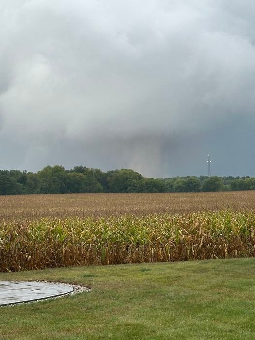
A photograph has been circulating online showing what appears to be a tornado near Royer Lake in LaGrange County, east of Valentine.
The tornado is visible behind the tree line in the area of 300 South and 300 East.
This is a developing story that will be updated when more information is available.


BLOOMINGTON, Ind. — Emergency responders are working multiple rescue calls after a confirmed tornado touched down west of Bloomington and moved directly toward the city, prompting urgent shelter warnings across the region.
The National Weather Service issued a Tornado Warning for Bloomington, Ellettsville, and Clear Creek until 7:30 p.m. EST, describing the situation as particularly dangerous.
The tornado was confirmed on the ground approximately eight miles west of Bloomington and moving east at an estimated 40 miles per hour.
Authorities report that multiple homes have sustained significant damage, with early indications that several individuals may be trapped inside residences impacted by the storm.
Emergency crews are actively conducting search and rescue operations in affected neighborhoods.
Communities directly in the projected path included Bloomington, Ellettsville, the campus of Indiana University Bloomington, Solsberry, and Whitehall.
Meteorologists warned that the storm was capable of producing destructive winds and hail up to the size of ping pong balls. Officials emphasized that the tornado posed a serious threat to life and property.
Residents in the warned area were urged to seek shelter immediately — preferably in a basement or on the lowest level of a sturdy structure, inside an interior room away from windows.
Authorities stressed not to delay action while waiting for visual confirmation of the tornado.
Emergency management officials continue to monitor the storm’s track and assess damage. Additional updates are expected as response efforts continue and more information becomes available.