
Weather
Tornado Touchdown in Mayville, Multiple Structures Damaged in Dodge County

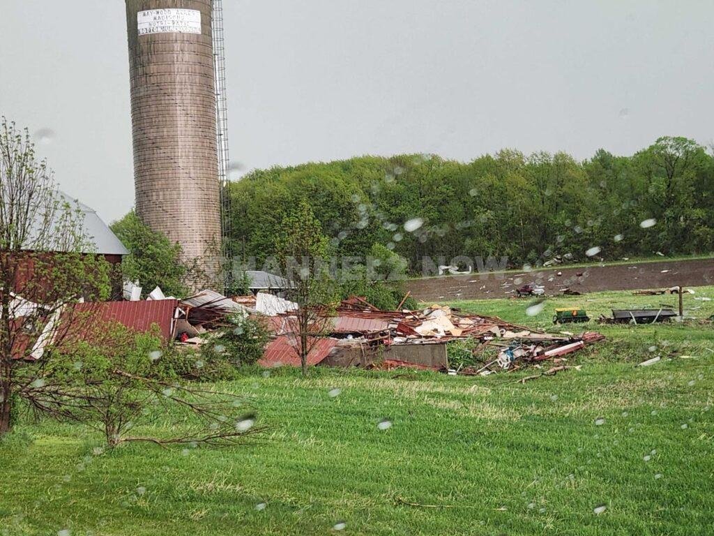
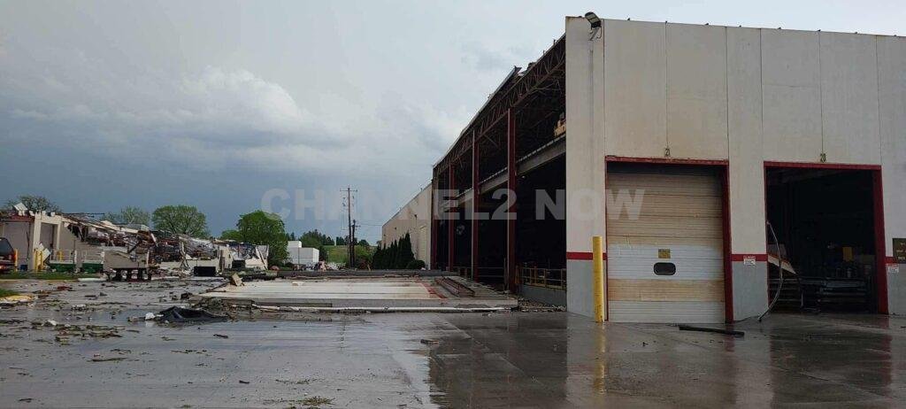
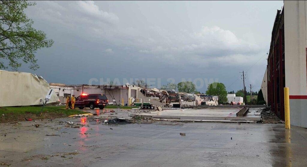
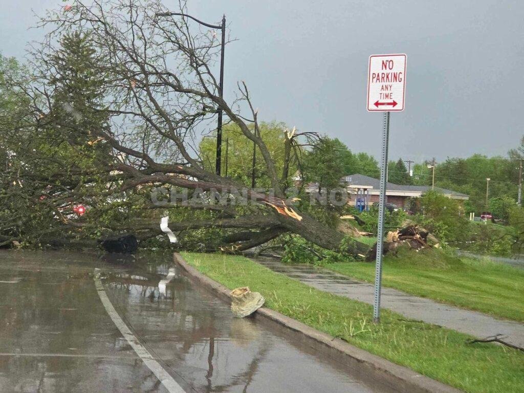
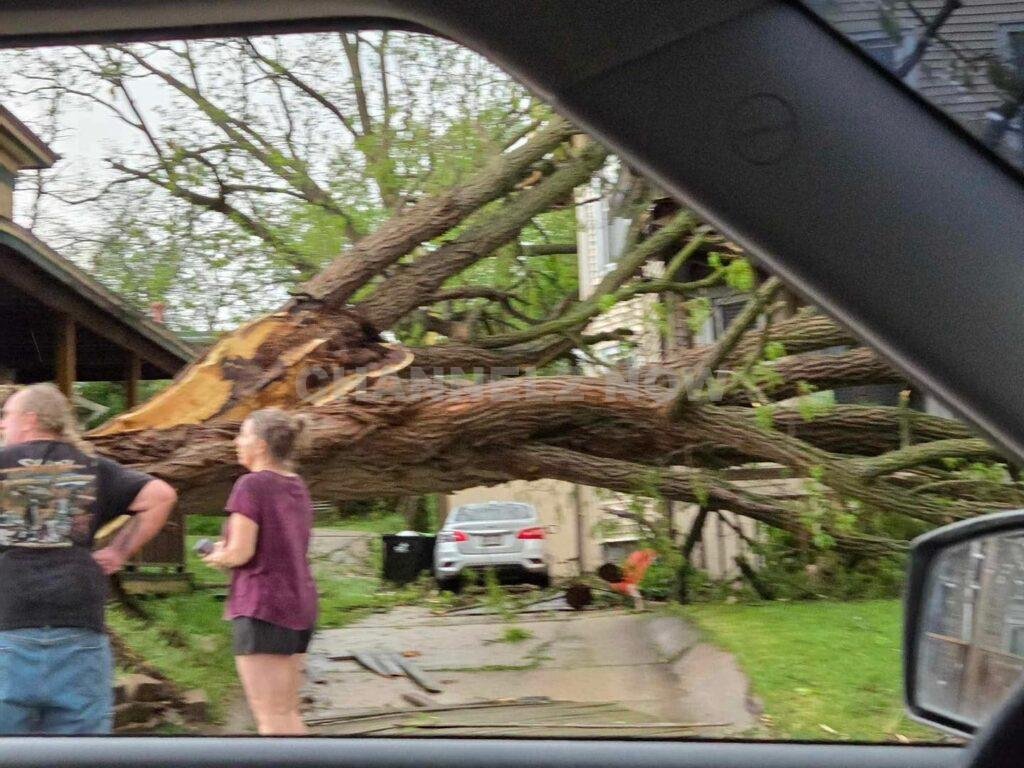
MAYVILLE, Wis. — Emergency crews responded to widespread storm damage in Dodge County Thursday evening after a confirmed tornado touched down in the city of Mayville, causing significant destruction to structures across the area.
The National Weather Service (NWS) confirmed that radar indicated a tornado in Dodge County shortly after 6:00 p.m., with the system appearing to make direct impact on parts of Mayville.
In response, a MABAS (Mutual Aid Box Alarm System) disaster response alarm was activated to mobilize additional emergency resources to the affected areas.
According to Dodge County Emergency Management, multiple reports of heavy damage have been confirmed, including along Clark Street near Mayville High School and at the Mayville Engineering Company (MEC) facility. Officials are currently assessing the full extent of the damage, but early indications point to severe structural impacts.
Several surrounding communities in southern Wisconsin also reported storm-related damage as the severe weather system moved through the region Thursday afternoon.
Emergency response teams remain on scene, and authorities are urging residents to avoid impacted areas to allow for cleanup and recovery operations.

Further updates will be provided as more information becomes available from local officials and the National Weather Service.


BLOOMINGTON, Ind. — Emergency responders are working multiple rescue calls after a confirmed tornado touched down west of Bloomington and moved directly toward the city, prompting urgent shelter warnings across the region.
The National Weather Service issued a Tornado Warning for Bloomington, Ellettsville, and Clear Creek until 7:30 p.m. EST, describing the situation as particularly dangerous.
The tornado was confirmed on the ground approximately eight miles west of Bloomington and moving east at an estimated 40 miles per hour.
Authorities report that multiple homes have sustained significant damage, with early indications that several individuals may be trapped inside residences impacted by the storm.
Emergency crews are actively conducting search and rescue operations in affected neighborhoods.
Communities directly in the projected path included Bloomington, Ellettsville, the campus of Indiana University Bloomington, Solsberry, and Whitehall.
Meteorologists warned that the storm was capable of producing destructive winds and hail up to the size of ping pong balls. Officials emphasized that the tornado posed a serious threat to life and property.
Residents in the warned area were urged to seek shelter immediately — preferably in a basement or on the lowest level of a sturdy structure, inside an interior room away from windows.
Authorities stressed not to delay action while waiting for visual confirmation of the tornado.
Emergency management officials continue to monitor the storm’s track and assess damage. Additional updates are expected as response efforts continue and more information becomes available.