
Weather
Tornado Emergency Declared for Madison and Huntsville, Alabama Amid Large and Destructive Storm
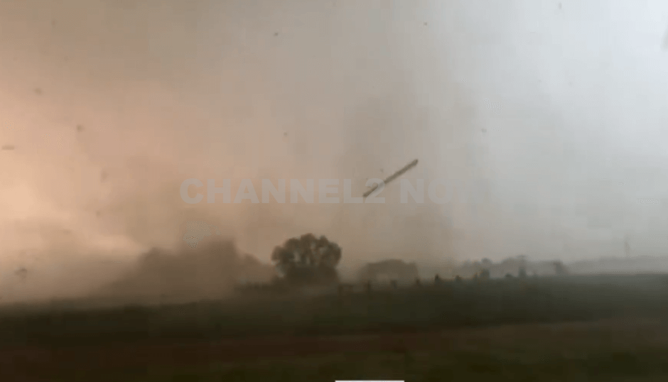
MADISON, AL — A tornado emergency was declared Tuesday evening for portions of Madison, Huntsville, and surrounding areas as a large, destructive tornado was confirmed on the ground west of Madison, moving east at 35 mph.
The National Weather Service (NWS) issued the urgent alert at 6:22 p.m. CDT, calling the situation a “Particularly Dangerous Situation” and urging residents in the storm’s path to seek immediate shelter.
Radar imagery indicated a significant debris ball over one mile wide, confirming the tornado’s intensity and potential for catastrophic damage.
The storm system has already produced multiple rotating cells across northern Alabama, with two major areas of concern — one near Muscle Shoals and another south of Rogersville — both exhibiting strong tornado potential.
The tornado emergency remained in effect until 6:45 p.m. for western Madison County, eastern Limestone County, and the cities of Madison, Huntsville, and Athens. Emergency officials warned of an imminent and serious threat to life and property.
“Take shelter now,” the NWS urged. “Go to the lowest level of your home, away from windows, and put as many walls between you and the outside as possible.”
Multiple emergency management agencies are monitoring the situation, and residents are advised to stay alert to evolving warnings and updates through official weather channels.


BLOOMINGTON, Ind. — Emergency responders are working multiple rescue calls after a confirmed tornado touched down west of Bloomington and moved directly toward the city, prompting urgent shelter warnings across the region.
The National Weather Service issued a Tornado Warning for Bloomington, Ellettsville, and Clear Creek until 7:30 p.m. EST, describing the situation as particularly dangerous.
The tornado was confirmed on the ground approximately eight miles west of Bloomington and moving east at an estimated 40 miles per hour.
Authorities report that multiple homes have sustained significant damage, with early indications that several individuals may be trapped inside residences impacted by the storm.
Emergency crews are actively conducting search and rescue operations in affected neighborhoods.
Communities directly in the projected path included Bloomington, Ellettsville, the campus of Indiana University Bloomington, Solsberry, and Whitehall.
Meteorologists warned that the storm was capable of producing destructive winds and hail up to the size of ping pong balls. Officials emphasized that the tornado posed a serious threat to life and property.
Residents in the warned area were urged to seek shelter immediately — preferably in a basement or on the lowest level of a sturdy structure, inside an interior room away from windows.
Authorities stressed not to delay action while waiting for visual confirmation of the tornado.
Emergency management officials continue to monitor the storm’s track and assess damage. Additional updates are expected as response efforts continue and more information becomes available.