
Weather
Tornado on the ground near Willard, Colorado
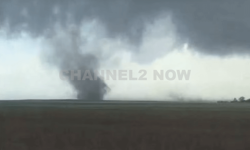
DENVER, CO — The National Weather Service (NWS) in Denver has issued a Tornado Warning for southwestern Logan County and north-central Washington County in northeastern Colorado, effective until 5:45 p.m. MDT Friday.
At 5:11 p.m., weather spotters confirmed a tornado on the ground near Merino, approximately 11 miles southwest of Sterling, moving southeast at 20 miles per hour.
The storm system is producing a dangerous and damaging tornado, with the potential for:
- Flying debris posing serious risk to those outdoors or in vehicles
- Structural damage to homes, roofs, windows, and vehicles
- Uprooted trees and downed power lines
- Total destruction of mobile homes
Communities directly in the path of the tornado include:
- Merino
- Prewitt Reservoir
- Atwood
- Logan Corners
- Willard
- Messex
Residents in these areas should seek shelter immediately. The safest option is to move to a basement or an interior room on the lowest floor of a sturdy building, away from windows and exterior walls.
Do not attempt to outrun the tornado in a vehicle. If no shelter is available, lie flat in a low-lying area and protect your head.
This is a confirmed tornado, not just radar-indicated. Immediate action is critical to ensuring safety.
Continue monitoring local media, NOAA weather radio, or official NWS alerts for real-time updates.


NEW JERSEY – Torrential rainfall has triggered widespread flash flooding across northern New Jersey, leaving roadways submerged, traffic paralyzed, and numerous motorists stranded.
In response to the rapidly deteriorating conditions, Governor Phil Murphy declared a State of Emergency Monday evening at 7:33 p.m., urging residents to stay indoors and avoid unnecessary travel.
“Please stay indoors and avoid unnecessary travel. Stay safe, New Jersey,” Murphy wrote in a statement released on social media.
The flash flooding has severely impacted several major roadways, including:
- Route 22: Entire sections of the highway were completely underwater, with numerous vehicles stalled in rising floodwaters. Emergency responders are on scene assisting trapped motorists.
- New Jersey Turnpike: Near Newark, both northbound and southbound lanes experienced heavy flooding, resulting in lane closures and significant traffic delays. Some areas of the Turnpike are reported to be completely impassable as water levels continue to rise.
Residents described scenes of devastation, with roads transformed into rivers and entire neighborhoods inundated. Video footage from affected areas shows cars partially submerged, and water rushing through intersections and parking lots.
Officials have issued a strong warning: “Turn Around, Don’t Drown.” Flash flooding remains an active threat as more rain is forecast throughout the evening and into Tuesday.
Emergency management teams across the state are working to coordinate response efforts, deploy high-water rescue vehicles, and mitigate further flooding.
Despite the swift response, public reaction has been mixed, with some residents criticizing the timing and preparedness of local and state agencies.
One social media user remarked, “Don’t bother calling FEMA, nobody will answer,” reflecting growing frustration over emergency response delays.
The duration of the State of Emergency remains unclear, but officials stress that residents should continue to monitor official alerts, follow emergency guidance, and contact 2-1-1 for shelter assistance if displaced.
If you are experiencing a flood-related emergency, contact local authorities immediately.
This is a developing situation. More updates will follow as the weather event continues to unfold.