
Weather
West Virginia Devastated by Flash Floods: At Least Four Dead, Four Missing, Widespread Destruction Reported

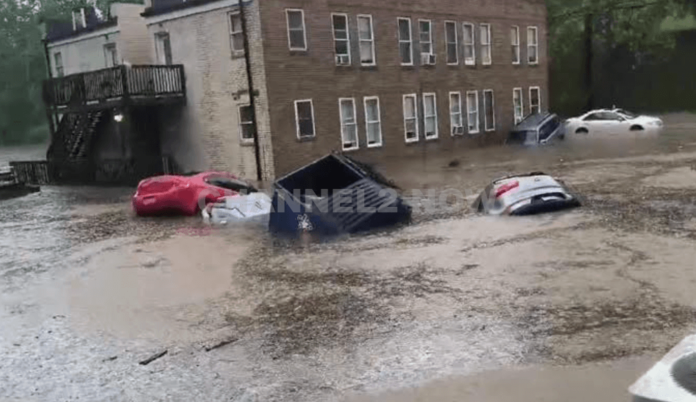
FAIRMONT, WV – Catastrophic flash flooding across parts of West Virginia has left at least four people dead, including a 3-year-old child, and four others missing, state officials confirmed to Channel2 NOW.
The disaster has prompted a state of emergency declaration for Ohio County and widespread deployment of emergency resources.
West Virginia Governor Patrick Morrisey described the flooding as a “unicorn event” during a Sunday briefing, emphasizing the severity and unusual nature of the storm. “Up to four inches of rain fell in extremely localized areas in under an hour. That’s very, very difficult to deal with,” Morrisey said.
The worst of the flooding initially struck late Saturday in the city of Wheeling and the surrounding towns of Triadelphia and Valley Grove.
The torrential rain overwhelmed creeks, culverts, and storm drains, leading to rapid-onset flash floods that inundated homes and roads.
Among the four confirmed fatalities is a young child, aged 3.
Authorities say four additional individuals remain unaccounted for, and search and rescue efforts are continuing around the clock. Emergency personnel have already conducted at least 19 swiftwater rescues in the affected areas.
The Governor’s Office has been in direct communication with the Federal Emergency Management Agency (FEMA) and other federal agencies. Volunteers and non-profit organizations are being mobilized to assist in recovery and relief operations.
Multiple state agencies, including the West Virginia Division of Natural Resources, the National Guard, and the Department of Highways, have deployed specialized equipment to support search and recovery. Resources include drones, UTVs, boats, and dive teams.
Valley Grove’s municipal water system has been completely disabled due to flood damage, and more than a dozen roads and three bridges in Ohio County have been closed. As of early Sunday afternoon, around 25,000 residents were without electricity across the region.
Elsewhere in the state, new flash flooding struck the city of Fairmont in Marion County on Sunday, where reports confirmed a partial collapse of an apartment building on Locust Avenue.
Emergency crews are assessing the scene, but no casualty figures have been confirmed from that location as of this writing.
The National Weather Service has issued a flash flood emergency for the Fairmont area, affecting approximately 46,000 residents.
The warning remains in effect until at least 7:15 p.m. and urges residents to seek higher ground and avoid flooded roadways.
“This is a life-threatening situation,” the agency warned. “Avoid walking or driving through floodwaters.”
Governor Morrisey urged residents across northern and central West Virginia to remain vigilant, follow emergency instructions, and avoid unnecessary travel in impacted areas. He also thanked first responders, volunteers, and neighboring states for their support.
West Virginians are reminded to report any missing persons or hazardous conditions to emergency services immediately. Recovery efforts are expected to extend into the coming days as the full extent of the damage becomes clearer.











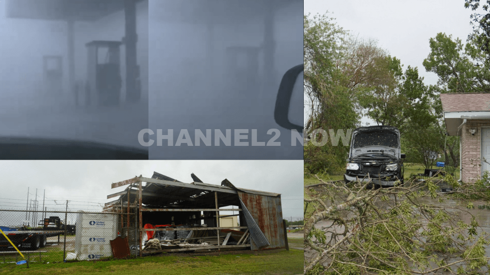
POINT COMFORT, Texas — Powerful thunderstorms swept across parts of the Texas Gulf Coast, producing extreme wind gusts that caused significant destruction in Point Comfort and surrounding areas, according to the National Weather Service (NWS).
A WeatherFlow HurrNet station recorded a peak wind gust of 119 miles per hour in Point Comfort, indicating a highly destructive wind event—likely a downburst associated with a line of severe thunderstorms that moved through the region.
Nearby communities also experienced intense conditions, with wind gusts reaching 77 mph in Palacios, Texas.
Widespread Storm Damage Reported
Preliminary reports indicate extensive damage stretching from near Coleto Creek Reservoir southeast through Point Comfort and toward Port O’Connor.
Residents and storm observers described scenes of severe impact consistent with extreme straight-line winds.
Reported damage includes:
- Downed power lines and widespread power outages across Point Comfort
- Large transmission towers toppled or severely damaged
- Trees uprooted or snapped at the base, with some falling onto homes
- Metal structures and roofing materials torn from buildings
- Vehicles, including trucks and boats, overturned by strong winds
- Billboards destroyed and outdoor infrastructure heavily damaged
One eyewitness described winds “easily exceeding 100 mph,” noting that debris, including large pieces of metal, was ripped from nearby buildings.
Additional reports suggest that a semi-truck parked at an industrial site was flipped, further underscoring the intensity of the wind event.
Possible Downburst Under Investigation
Meteorologists believe the damage pattern is consistent with a downburst, a powerful column of sinking air that spreads outward upon reaching the ground, producing intense and localized wind damage.
However, the National Weather Service has confirmed that a formal damage survey will be conducted to determine the exact cause.
Community Urged to Share Information
Officials are asking residents to submit photos, videos, and damage reports, including locations and estimated times, to assist with the ongoing assessment.
This information will help meteorologists better understand the storm’s impact and confirm whether the event was solely caused by straight-line winds or involved additional severe weather factors.
Ongoing Recovery Efforts
Emergency crews and utility workers are actively responding to restore power and clear debris as residents begin recovery efforts.
Authorities continue to urge caution in affected areas due to downed lines, unstable structures, and hazardous debris.
This severe weather event highlights the destructive potential of fast-moving thunderstorm systems and the importance of staying alert during rapidly changing weather conditions.