
Weather
At least one killed after strong and dangerous tornado moved through Oklahoma City metro area
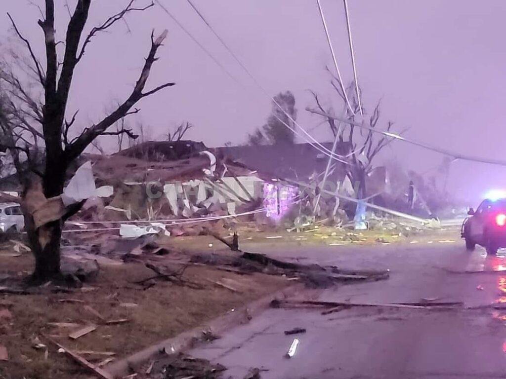
A powerful and dangerous storm system tore through the Oklahoma City metro area overnight on Saturday, leaving a trail of destruction and chaos.
Several tornadoes were reported to have touched down in southeastern Oklahoma City, severely impacting communities like Valley Brook, Del City, and Harrah.
The worst-hit area was Valley Brook, where homes were completely destroyed, prompting urgent search and rescue operations early Sunday morning.
Emergency responders and residents worked side-by-side, pulling people from their destroyed homes and guiding them to safer shelters, fearing additional tornadoes might follow.


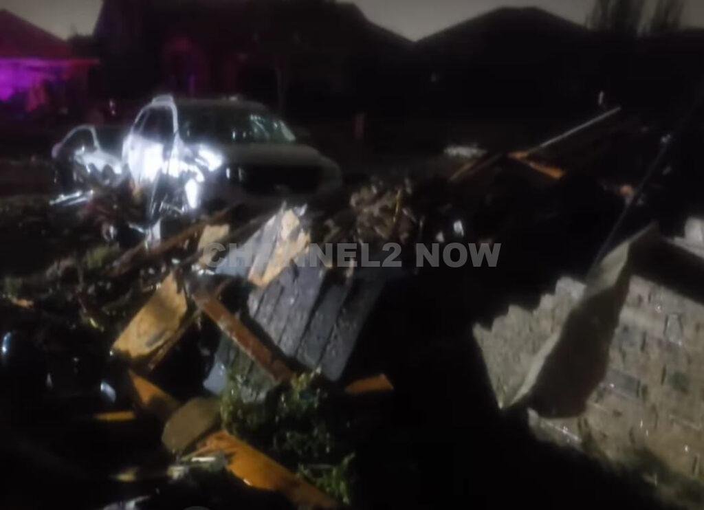


Tragically, one fatality has been confirmed, and several others sustained serious injuries. Reports detail scenes of devastation, with houses demolished, vehicles tossed around, and residents trapped amid widespread gas leaks.
In Oklahoma City, six people were reported injured and required hospital treatment.
According to the Oklahoma City Police Department, five of these injuries were concentrated in one specific area, though fortunately, none were life-threatening.
Southeastern Oklahoma City experienced multiple gas leaks, exacerbating the already hazardous conditions.
Across Oklahoma City and Del City, the storm left power lines and large trees uprooted. As of early Sunday morning, over 35,000 residents were without power.
The City of Choctaw’s mayor, Chad Allcox, posted an update on Facebook early Sunday morning:
Please keep the City of Choctaw, OK and Town of Harrah in your thoughts and prayers. Significant damage has been reported in both locations. Thank you to our staff, and first responders for working through the night.
This is the beginning of a few days of historical rain amounts and severe storms. Please be careful traveling the roads around the metro and the City of Choctaw. Our city crew are out working to shut down areas of high water throughout the night.
Oklahoma City police have urged residents to avoid southeastern Oklahoma City while recovery and repair efforts continue.


BLOOMINGTON, Ind. — Emergency responders are working multiple rescue calls after a confirmed tornado touched down west of Bloomington and moved directly toward the city, prompting urgent shelter warnings across the region.
The National Weather Service issued a Tornado Warning for Bloomington, Ellettsville, and Clear Creek until 7:30 p.m. EST, describing the situation as particularly dangerous.
The tornado was confirmed on the ground approximately eight miles west of Bloomington and moving east at an estimated 40 miles per hour.
Authorities report that multiple homes have sustained significant damage, with early indications that several individuals may be trapped inside residences impacted by the storm.
Emergency crews are actively conducting search and rescue operations in affected neighborhoods.
Communities directly in the projected path included Bloomington, Ellettsville, the campus of Indiana University Bloomington, Solsberry, and Whitehall.
Meteorologists warned that the storm was capable of producing destructive winds and hail up to the size of ping pong balls. Officials emphasized that the tornado posed a serious threat to life and property.
Residents in the warned area were urged to seek shelter immediately — preferably in a basement or on the lowest level of a sturdy structure, inside an interior room away from windows.
Authorities stressed not to delay action while waiting for visual confirmation of the tornado.
Emergency management officials continue to monitor the storm’s track and assess damage. Additional updates are expected as response efforts continue and more information becomes available.