Weather
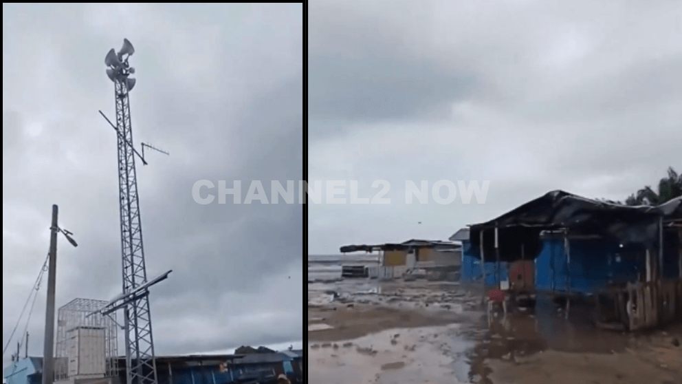
Sirens Wail Across Jamaica Old Harbour Bay as Powerful Hurricane Melissa Approaches Landfall

OLD HARBOUR BAY, JAMAICA — Emergency sirens are sounding across Jamaica’s southern coast as Hurricane Melissa, a powerful and rapidly intensifying Category 4 storm, bears down on the island.
The National Hurricane Center (NHC) warns that Melissa could strengthen further into a catastrophic Category 5 hurricane before making landfall late Monday night or early Tuesday morning.
In its 5 p.m. ET advisory on Sunday, the NHC confirmed that Melissa has resumed intensification, with satellite and reconnaissance data showing a small, well-defined eye and a highly organized inner core — indicators of a major hurricane gaining strength.
“Hurricane Melissa has intensified again,” the NHC stated. “Melissa could make landfall as a catastrophic Category 5 hurricane.”
As of the latest update, Melissa is producing maximum sustained winds of 145 mph (230 km/h) and is moving westward at 5 mph (8 km/h).
The storm’s center was located approximately 115 miles south-southwest of Kingston, Jamaica, with a central pressure of 941 millibars, suggesting continued strengthening in the hours ahead.
Forecasters warn that life-threatening storm surge, destructive hurricane-force winds, and torrential rainfall could cause catastrophic damage across large portions of Jamaica.
- Rainfall totals: Up to 40 inches (1,000 mm) in isolated areas.
- Storm surge: 9–13 feet possible along Jamaica’s southern coastline.
- Wind damage: Widespread structural damage and long-term power outages are expected.
- Flooding and landslides: Flash flooding and mudslides likely across mountainous terrain.
In a key message Sunday evening, the NHC urged immediate protective action:
“Seek shelter now. Extensive infrastructural damage, long-duration power and communication outages, and isolation of communities are expected.”
- Hurricane Warning: Entire island of Jamaica and four provinces in eastern Cuba, including Guantánamo.
- Tropical Storm Warning: Las Tunas Province, Cuba.
- Tropical Storm and Hurricane Watches: Southern Haiti, where conditions may deteriorate by late Monday.
Current projections show Melissa continuing westward before making a sharp northeastward turn toward southeastern Cuba late Tuesday.
The storm could make a second landfall in Cuba before crossing the southeastern Bahamas midweek, eventually moving back into the open Atlantic by Thursday.
If Melissa maintains its strength and current path, it could rank among the strongest hurricanes ever to make direct landfall in Jamaica.
Emergency officials in Jamaica are urging all residents to complete preparations immediately, secure property, and relocate to designated hurricane shelters. Authorities warn that rescue operations may be impossible during the peak of the storm due to dangerous conditions.
Residents in coastal and low-lying areas are being told to evacuate immediately as conditions in regions like Old Harbour Bay, Clarendon, and Kingston Parish rapidly deteriorate.
This is a developing situation. Further updates will be issued by the National Hurricane Center, the Jamaica Meteorological Service, and local emergency management agencies as Hurricane Melissa approaches landfall.
Weather
Multiple people trapped in houses from tornado near Bloomington

BLOOMINGTON, Ind. — Emergency responders are working multiple rescue calls after a confirmed tornado touched down west of Bloomington and moved directly toward the city, prompting urgent shelter warnings across the region.
The National Weather Service issued a Tornado Warning for Bloomington, Ellettsville, and Clear Creek until 7:30 p.m. EST, describing the situation as particularly dangerous.
The tornado was confirmed on the ground approximately eight miles west of Bloomington and moving east at an estimated 40 miles per hour.
Authorities report that multiple homes have sustained significant damage, with early indications that several individuals may be trapped inside residences impacted by the storm.
Emergency crews are actively conducting search and rescue operations in affected neighborhoods.
Communities directly in the projected path included Bloomington, Ellettsville, the campus of Indiana University Bloomington, Solsberry, and Whitehall.
Meteorologists warned that the storm was capable of producing destructive winds and hail up to the size of ping pong balls. Officials emphasized that the tornado posed a serious threat to life and property.
Residents in the warned area were urged to seek shelter immediately — preferably in a basement or on the lowest level of a sturdy structure, inside an interior room away from windows.
Authorities stressed not to delay action while waiting for visual confirmation of the tornado.
Emergency management officials continue to monitor the storm’s track and assess damage. Additional updates are expected as response efforts continue and more information becomes available.


