
Weather
Large tornado on the ground near Bennett, Colorado

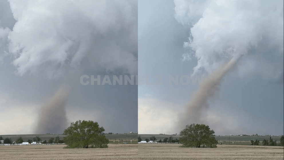
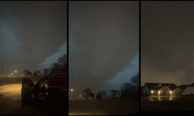
A series of tornadoes touched down in eastern Colorado on Sunday afternoon, with one large and potentially damaging tornado captured on a Colorado Department of Transportation (CDOT) traffic camera near Bennett.
The twister was seen crossing Interstate 70 east of Denver, between the towns of Bennett and Watkins, and was described by forecasters as potentially causing “significant damage.”
The National Weather Service (NWS) reported at least six tornado sightings across the region as severe thunderstorms swept through.
The tornado near Bennett was one of the most visible, with over a minute of dramatic footage recorded on a CDOT webcam, showing a well-defined funnel making contact with the ground just east of Denver International Airport.
The storm moved in a northeast direction, threatening areas including Wiggins, Hoyt, Fort Morgan, and Brush.
As of 2:30 p.m., two tornadoes were confirmed near Arapahoe Park, roughly 25 miles southeast of Denver, and three separate tornado reports came in from the Bennett area, located approximately 32 miles east of the city.
One tornado in particular, deemed “extremely dangerous” by the NWS, was confirmed on the ground around 1:50 p.m. about nine miles north of Strasburg. It was moving northeast at 20 miles per hour.
That tornado prompted a warning covering much of central Adams County, which was lifted by 2:15 p.m.
Meteorologists are still working to determine how many of Sunday’s tornado reports represent distinct tornadoes versus multiple sightings of the same storm system.
In addition to the tornado activity, large hail accompanied the storms. Reports of hail ranging from the size of dimes to ping pong balls were recorded across the region.
The largest confirmed hailstone as of mid-afternoon was 1.5 inches in diameter, reported near East Smoky Hill Road and South Powhaton Road in Aurora.
Emergency officials continue to monitor the situation and are assessing the extent of damage in affected areas.
Residents are urged to remain alert as cleanup efforts begin and as the threat of additional storms may persist into the evening.








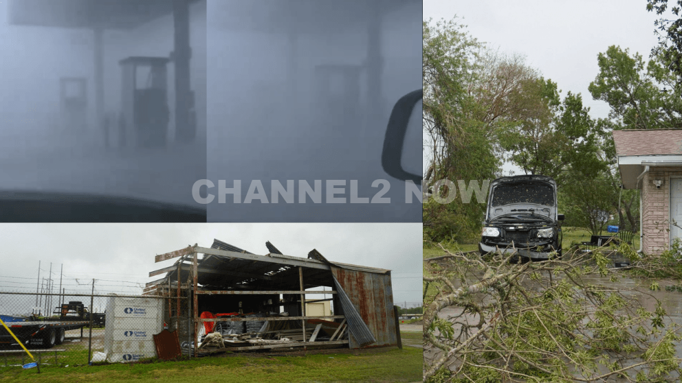
POINT COMFORT, Texas — Powerful thunderstorms swept across parts of the Texas Gulf Coast, producing extreme wind gusts that caused significant destruction in Point Comfort and surrounding areas, according to the National Weather Service (NWS).
A WeatherFlow HurrNet station recorded a peak wind gust of 119 miles per hour in Point Comfort, indicating a highly destructive wind event—likely a downburst associated with a line of severe thunderstorms that moved through the region.
Nearby communities also experienced intense conditions, with wind gusts reaching 77 mph in Palacios, Texas.
Widespread Storm Damage Reported
Preliminary reports indicate extensive damage stretching from near Coleto Creek Reservoir southeast through Point Comfort and toward Port O’Connor.
Residents and storm observers described scenes of severe impact consistent with extreme straight-line winds.
Reported damage includes:
- Downed power lines and widespread power outages across Point Comfort
- Large transmission towers toppled or severely damaged
- Trees uprooted or snapped at the base, with some falling onto homes
- Metal structures and roofing materials torn from buildings
- Vehicles, including trucks and boats, overturned by strong winds
- Billboards destroyed and outdoor infrastructure heavily damaged
One eyewitness described winds “easily exceeding 100 mph,” noting that debris, including large pieces of metal, was ripped from nearby buildings.
Additional reports suggest that a semi-truck parked at an industrial site was flipped, further underscoring the intensity of the wind event.
Possible Downburst Under Investigation
Meteorologists believe the damage pattern is consistent with a downburst, a powerful column of sinking air that spreads outward upon reaching the ground, producing intense and localized wind damage.
However, the National Weather Service has confirmed that a formal damage survey will be conducted to determine the exact cause.
Community Urged to Share Information
Officials are asking residents to submit photos, videos, and damage reports, including locations and estimated times, to assist with the ongoing assessment.
This information will help meteorologists better understand the storm’s impact and confirm whether the event was solely caused by straight-line winds or involved additional severe weather factors.
Ongoing Recovery Efforts
Emergency crews and utility workers are actively responding to restore power and clear debris as residents begin recovery efforts.
Authorities continue to urge caution in affected areas due to downed lines, unstable structures, and hazardous debris.
This severe weather event highlights the destructive potential of fast-moving thunderstorm systems and the importance of staying alert during rapidly changing weather conditions.