
Weather
Multiple fatalities reported after tornado causes destruction in Union City, Michigan

UPDATE: At least three people have died and 12 others were injured after a powerful tornado tore through Union City, Michigan, on Friday, according to the Branch County Sheriff’s Office.
Victims killed in Union City tornado identified
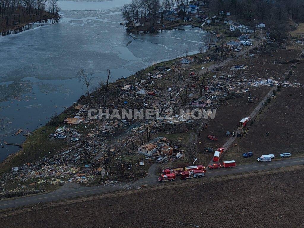
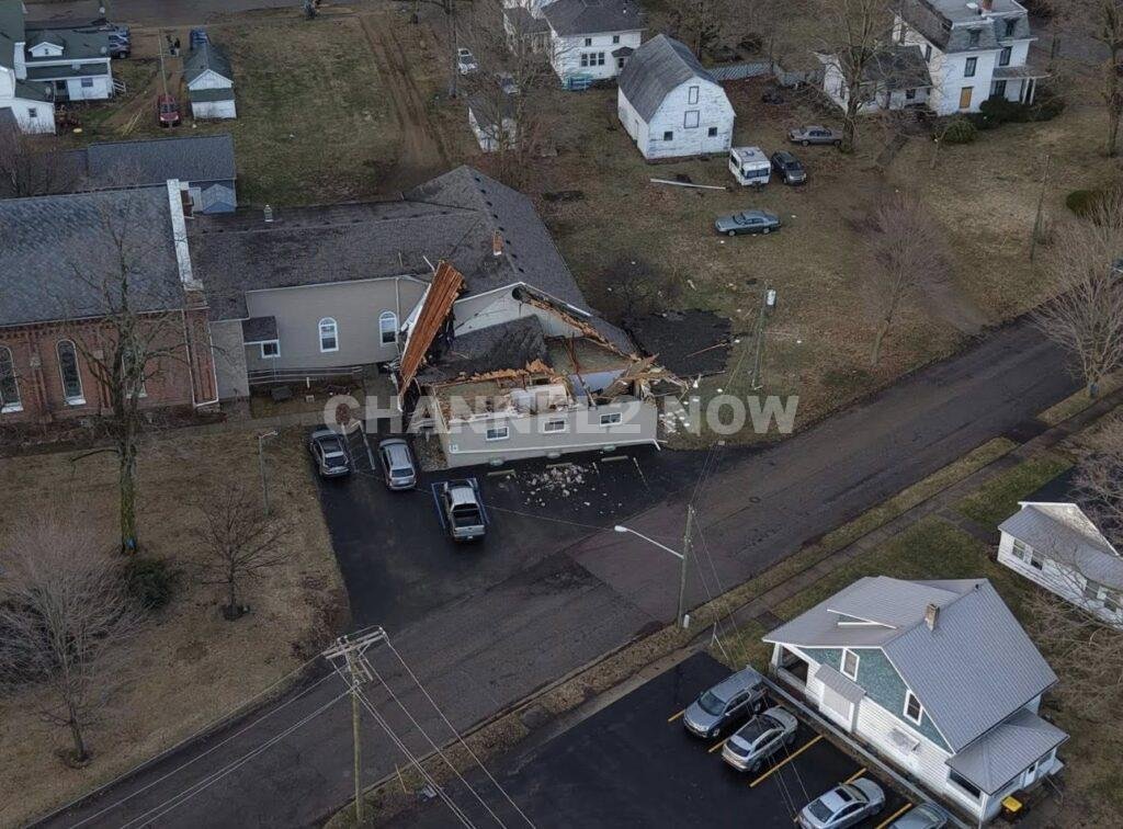
A powerful tornado tore through parts of southern Michigan on Friday, leaving a trail of catastrophic destruction in and around Union City in Branch County, with authorities and storm observers reporting multiple fatalities and widespread structural damage.
Emergency crews, storm chasers, and local residents described scenes of devastation after what officials believe was a large and extremely powerful tornado struck the community during a severe weather outbreak that impacted several areas across the state.
The tornado reportedly touched down near Union Lake, where witnesses described the storm as a massive wedge tornado — a type of tornado that appears wider than it is tall and is often associated with the most destructive storms.
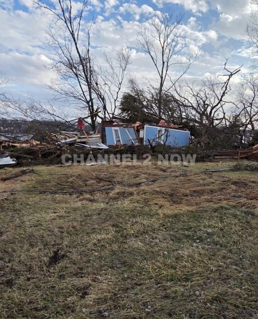
Homes were flattened, buildings were heavily damaged, and debris was scattered across neighborhoods as the tornado carved a destructive path through the community. Initial reports from storm chasers on the ground indicated damage consistent with at least EF-3 intensity, with estimated wind speeds exceeding 150 mph.
Several neighborhoods sustained severe damage, with entire homes reportedly reduced to their foundations.
Videos circulating online show the tornado moving directly through residential areas, tearing apart structures and uprooting trees.
First responders, volunteers, and community members quickly mobilized to assist those affected. Storm chasers who had been tracking the storm said they stopped their pursuit to help rescue people trapped in debris and damaged structures.
According to those at the scene, numerous volunteers and members of the community stepped in to assist with rescue efforts, creating what some described as a “massive turnout of Samaritans” helping victims in the aftermath.

However, hazardous conditions complicated rescue operations. Responders reported a propane tank leak and live electrical wires in the area, forcing some volunteers to temporarily evacuate the immediate disaster zone for safety reasons.
Authorities have confirmed that multiple people were killed as a result of the tornado, though officials have not yet released an official death toll. There are also unconfirmed reports of additional people missing as search and rescue operations continue.
Emergency responders are working through heavily damaged areas to locate survivors and account for residents who may still be trapped in collapsed structures.
The tornado was part of a broader severe weather outbreak that moved across southern Michigan and neighboring states Friday afternoon.
Severe thunderstorm warnings were also issued in northern Indiana, including Porter County and Lake County, while a severe thunderstorm watch extended across several counties in Illinois and Indiana as the storm system continued to move east.
Meteorologists say the storm that produced the tornado was relatively small but developed in an environment with extremely high atmospheric instability. Strong low-level energy and rotation along a warm front helped intensify the storm rapidly, creating conditions capable of producing a violent tornado.
Preliminary observations from meteorologists and storm chasers suggest the tornado may rank among the strongest to strike Michigan in decades. Some experts say it could be the most powerful tornado to impact the state since the devastating 1977 Kalamazoo tornado outbreak, which included a destructive F4 tornado.
Damage surveys by the National Weather Service will determine the official tornado rating in the coming days.
In addition to Union City, nearby communities including Three Rivers, Niles, and Edwardsburg also reported storm damage as the severe weather moved through the region.
Power companies have deployed crews to assess damage to the electrical grid and begin restoration efforts, though officials warn that full recovery will take time due to the extensive destruction.
Local organizations and volunteers are already organizing relief efforts to assist residents affected by the disaster.
Donation drives and supply collections are being coordinated to support communities impacted by the tornado and provide aid to families who have lost homes or belongings.
Officials are urging residents to remain alert as additional rounds of severe weather remain possible in the region.
Authorities continue to search damaged areas and gather information about the victims. Additional updates are expected as emergency crews complete search operations and damage assessments.











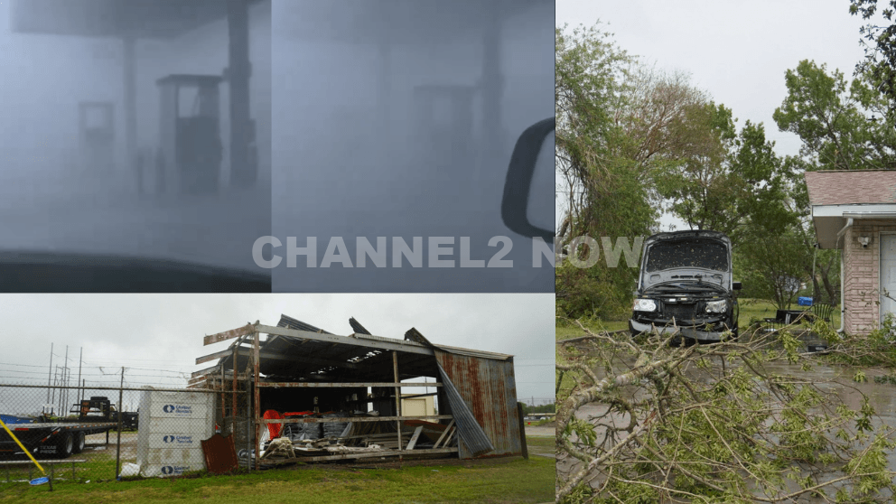
POINT COMFORT, Texas — Powerful thunderstorms swept across parts of the Texas Gulf Coast, producing extreme wind gusts that caused significant destruction in Point Comfort and surrounding areas, according to the National Weather Service (NWS).
A WeatherFlow HurrNet station recorded a peak wind gust of 119 miles per hour in Point Comfort, indicating a highly destructive wind event—likely a downburst associated with a line of severe thunderstorms that moved through the region.
Nearby communities also experienced intense conditions, with wind gusts reaching 77 mph in Palacios, Texas.
Widespread Storm Damage Reported
Preliminary reports indicate extensive damage stretching from near Coleto Creek Reservoir southeast through Point Comfort and toward Port O’Connor.
Residents and storm observers described scenes of severe impact consistent with extreme straight-line winds.
Reported damage includes:
- Downed power lines and widespread power outages across Point Comfort
- Large transmission towers toppled or severely damaged
- Trees uprooted or snapped at the base, with some falling onto homes
- Metal structures and roofing materials torn from buildings
- Vehicles, including trucks and boats, overturned by strong winds
- Billboards destroyed and outdoor infrastructure heavily damaged
One eyewitness described winds “easily exceeding 100 mph,” noting that debris, including large pieces of metal, was ripped from nearby buildings.
Additional reports suggest that a semi-truck parked at an industrial site was flipped, further underscoring the intensity of the wind event.
Possible Downburst Under Investigation
Meteorologists believe the damage pattern is consistent with a downburst, a powerful column of sinking air that spreads outward upon reaching the ground, producing intense and localized wind damage.
However, the National Weather Service has confirmed that a formal damage survey will be conducted to determine the exact cause.
Community Urged to Share Information
Officials are asking residents to submit photos, videos, and damage reports, including locations and estimated times, to assist with the ongoing assessment.
This information will help meteorologists better understand the storm’s impact and confirm whether the event was solely caused by straight-line winds or involved additional severe weather factors.
Ongoing Recovery Efforts
Emergency crews and utility workers are actively responding to restore power and clear debris as residents begin recovery efforts.
Authorities continue to urge caution in affected areas due to downed lines, unstable structures, and hazardous debris.
This severe weather event highlights the destructive potential of fast-moving thunderstorm systems and the importance of staying alert during rapidly changing weather conditions.