
Weather
Major flooding occurring in Hurley, Virginia – Flash Flood Emergency declared

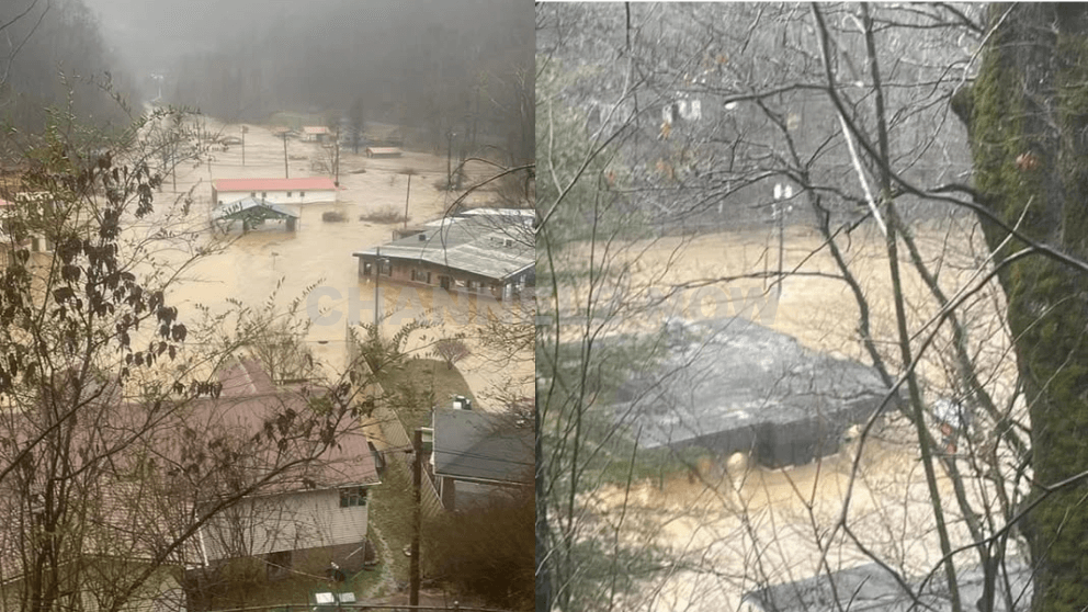
Hurley, VA – Authorities have declared a Flash Flood Emergency for Hurley, Virginia, as severe flooding submerges large portions of the community.
Nearby areas, including Grundy and Slate Creek, are also experiencing significant flood conditions, with emergency responders working to address the escalating crisis.
Heavy and persistent rainfall across regions of Kentucky, Tennessee, and Virginia has led to dangerous flooding, affecting homes, roadways, and critical infrastructure.
The Hurley area is currently inundated with rising waters, prompting urgent warnings for residents to seek higher ground and avoid flooded areas.
Emergency services have issued a Flash Flood Emergency—the most serious type of flood alert—indicating immediate life-threatening conditions and extensive property damage.
The flooding extends beyond Hurley, impacting nearby areas such as Grundy and Slate Creek, where water levels continue to rise.
Local officials report impassable roads, stranded residents, and ongoing rescue operations.
Emergency management teams are actively working to assist affected residents, while public safety officials urge the community to:
- Avoid driving through flooded roadways and low-lying areas.
- Seek higher ground immediately if located in flood-prone zones.
- Follow local emergency alerts and evacuation orders.
Meteorologists warn that additional rainfall is expected to exacerbate conditions, prolonging the risk of flash flooding across the region. Residents are advised to stay informed through official weather channels and heed all safety advisories.
This is a developing situation, and further updates will be provided as more information becomes available.












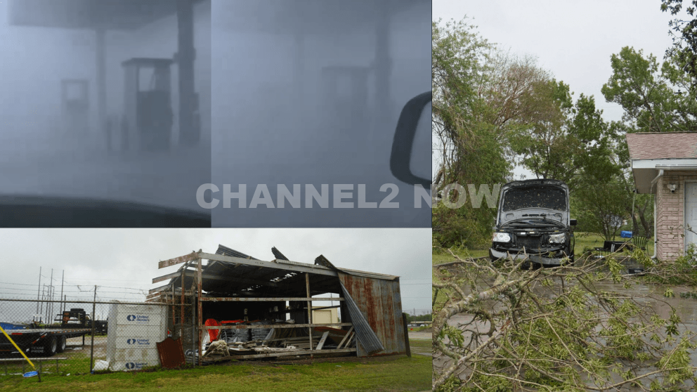
POINT COMFORT, Texas — Powerful thunderstorms swept across parts of the Texas Gulf Coast, producing extreme wind gusts that caused significant destruction in Point Comfort and surrounding areas, according to the National Weather Service (NWS).
A WeatherFlow HurrNet station recorded a peak wind gust of 119 miles per hour in Point Comfort, indicating a highly destructive wind event—likely a downburst associated with a line of severe thunderstorms that moved through the region.
Nearby communities also experienced intense conditions, with wind gusts reaching 77 mph in Palacios, Texas.
Widespread Storm Damage Reported
Preliminary reports indicate extensive damage stretching from near Coleto Creek Reservoir southeast through Point Comfort and toward Port O’Connor.
Residents and storm observers described scenes of severe impact consistent with extreme straight-line winds.
Reported damage includes:
- Downed power lines and widespread power outages across Point Comfort
- Large transmission towers toppled or severely damaged
- Trees uprooted or snapped at the base, with some falling onto homes
- Metal structures and roofing materials torn from buildings
- Vehicles, including trucks and boats, overturned by strong winds
- Billboards destroyed and outdoor infrastructure heavily damaged
One eyewitness described winds “easily exceeding 100 mph,” noting that debris, including large pieces of metal, was ripped from nearby buildings.
Additional reports suggest that a semi-truck parked at an industrial site was flipped, further underscoring the intensity of the wind event.
Possible Downburst Under Investigation
Meteorologists believe the damage pattern is consistent with a downburst, a powerful column of sinking air that spreads outward upon reaching the ground, producing intense and localized wind damage.
However, the National Weather Service has confirmed that a formal damage survey will be conducted to determine the exact cause.
Community Urged to Share Information
Officials are asking residents to submit photos, videos, and damage reports, including locations and estimated times, to assist with the ongoing assessment.
This information will help meteorologists better understand the storm’s impact and confirm whether the event was solely caused by straight-line winds or involved additional severe weather factors.
Ongoing Recovery Efforts
Emergency crews and utility workers are actively responding to restore power and clear debris as residents begin recovery efforts.
Authorities continue to urge caution in affected areas due to downed lines, unstable structures, and hazardous debris.
This severe weather event highlights the destructive potential of fast-moving thunderstorm systems and the importance of staying alert during rapidly changing weather conditions.